Wednesday, August 31, 2005
Lake Louise, Lake Agnes, Little Beehive, Plain of Six Glaciers, Banff National Park
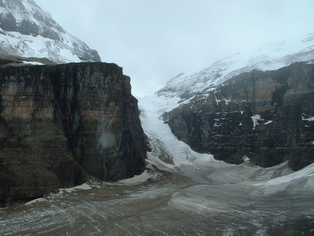
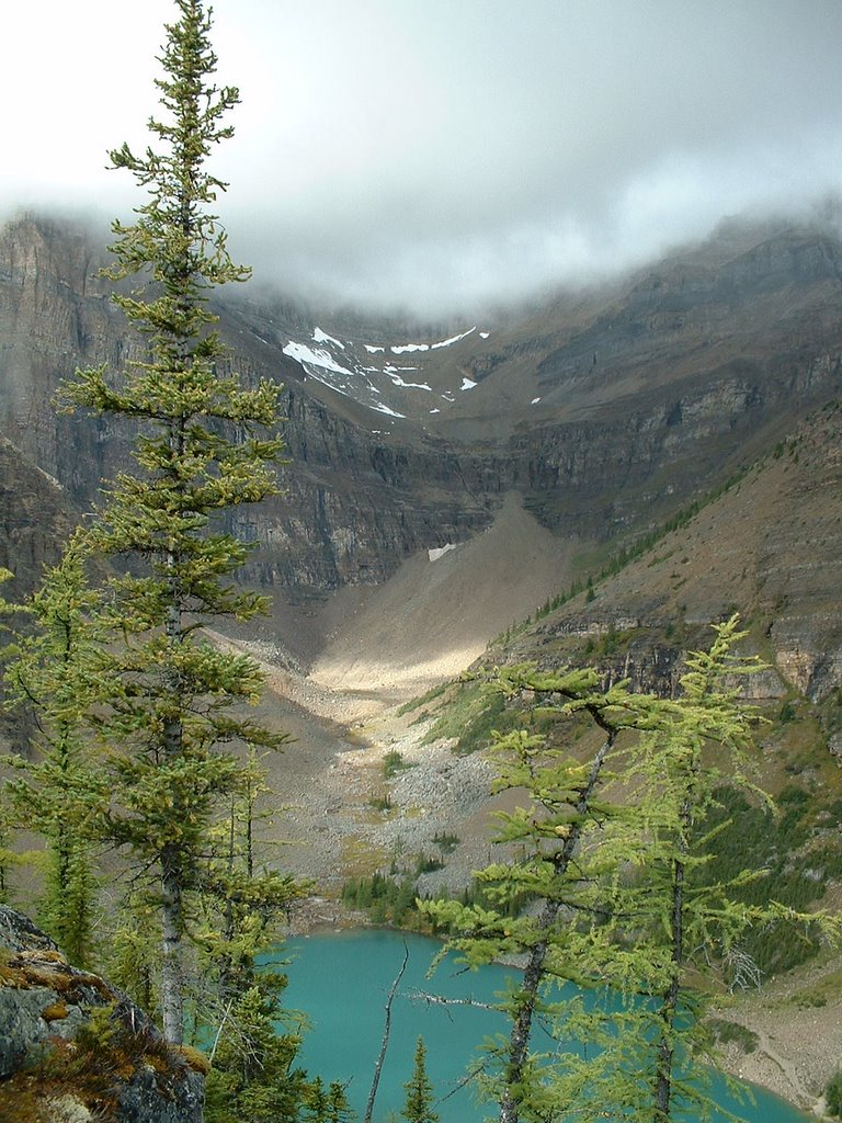
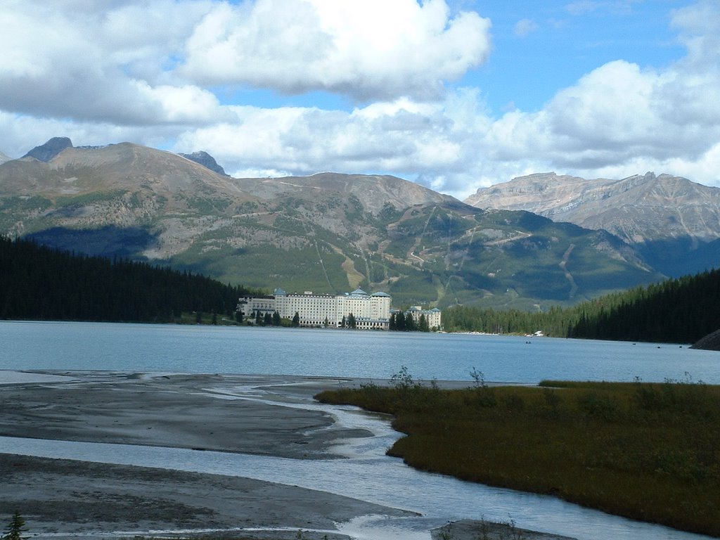
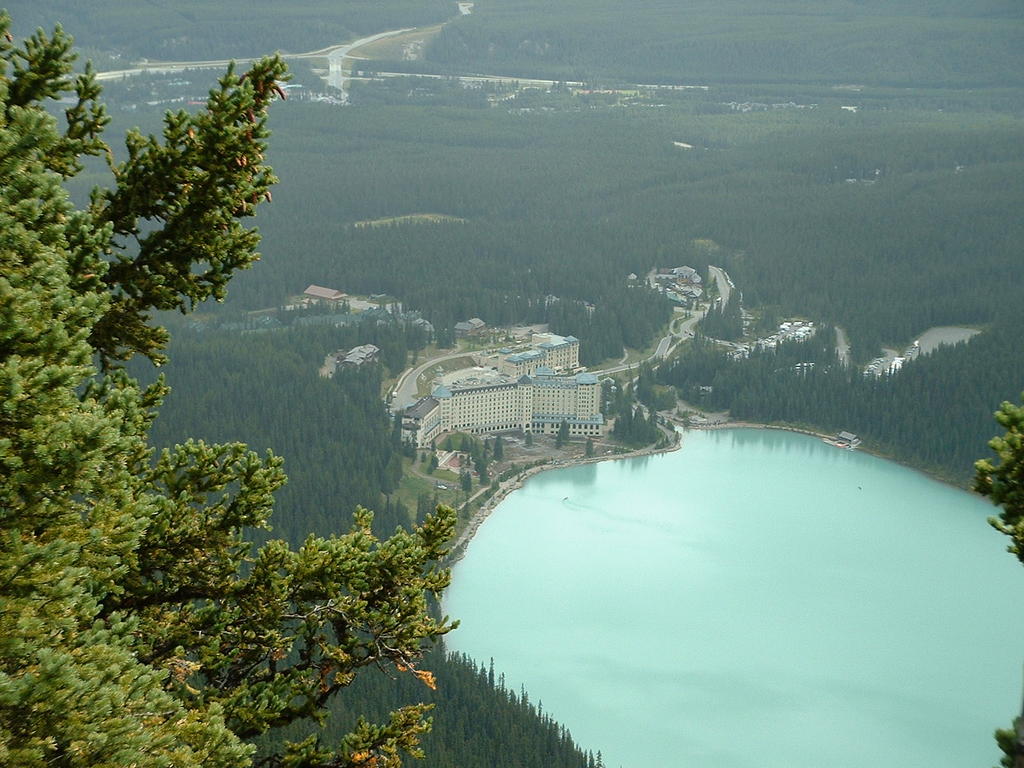
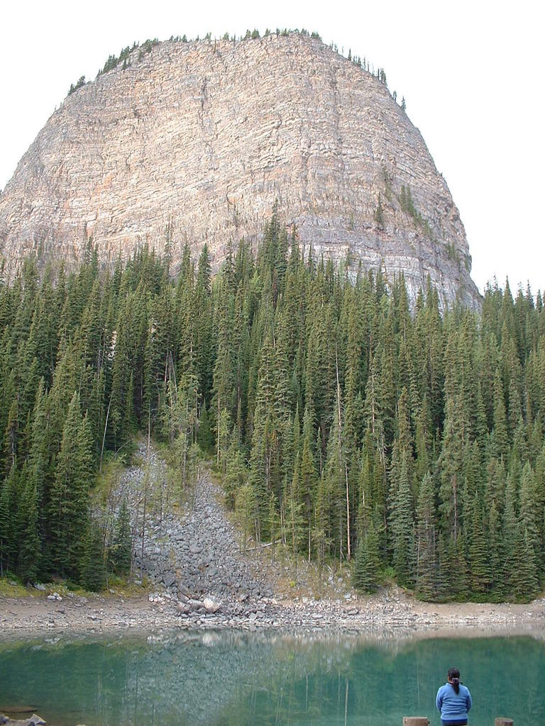
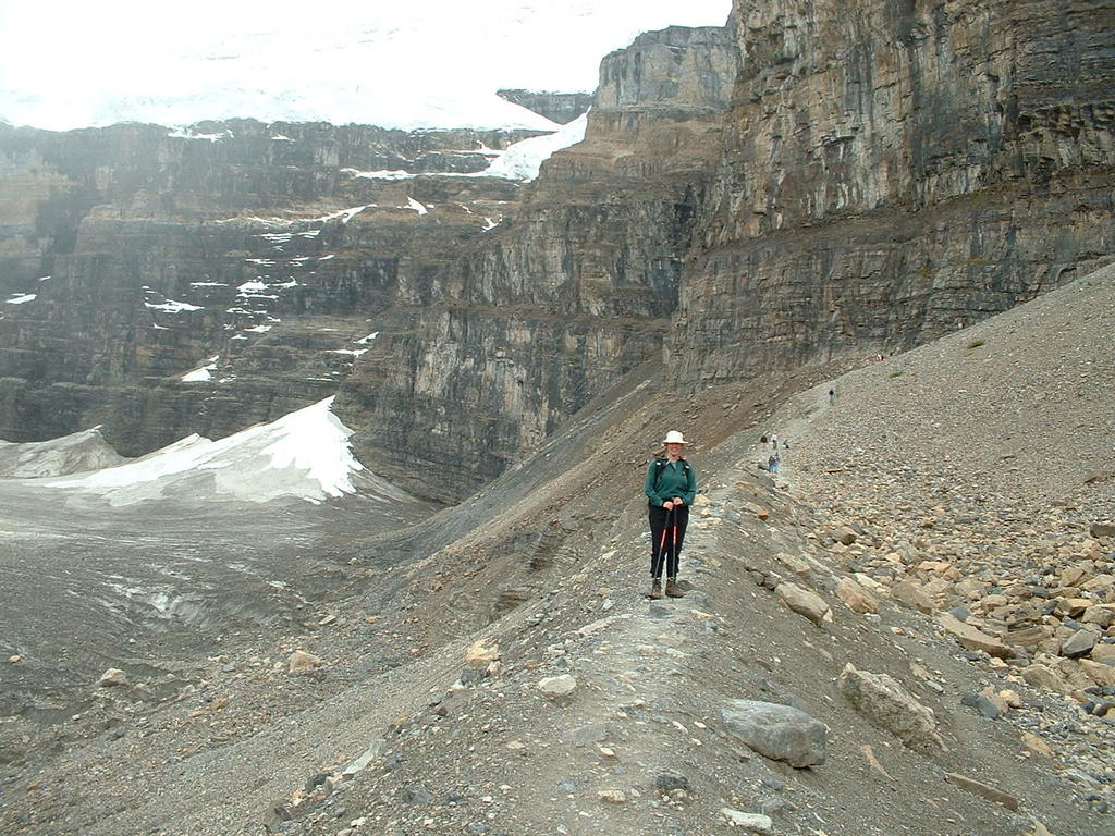
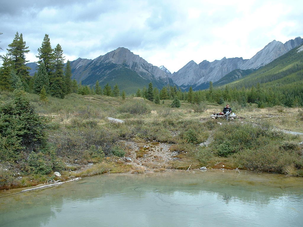
What a day! We spent the entire day hiking most of the trails in the Lake Louise area. We began at the Chateau and climbed to Lake Agnes, where we avoided the hub-bub of the teahouse and ate our GORP at a picnic table. After quickly refueling we headed around Lake Agnes, past a cool amphitheater, and ascended the Beehive, which had excellent views down to Lake Louise, the chateau, and across the Bow River Valley. The canoeists on the lake looked like little toy boats. Feeling good, we headed up the valley towards the Plain of Six Glaciers. It was a long slog with lots of tourists from all over the world. We again avoided the teahouse at Plain of Six Glaciers (gotta save gas money as gas prices were hurtling up because of Hurricane Katrina) and hiked the extra kilometer to the trail's terminus on a sharp-crested moraine. It was quite chilly and breezy up there, but it was neat to look down upon the glacier. We headed back down, with a nice stop alongside the stream to watch the milky gray water cascade down. I was so happy that Sara had such a positive attitude to keep going up to the Plain of Six Glaciers even though we were both quite tired by that point. But how many times are you going to be at Lake Louise?
Length: About 12 miles
Vertical Gain:
Weather: Partly Sunny to spitting rain and cold
Dog Rating: I hate you guys (stuck at the kennel)
Read more!
Tuesday, August 30, 2005
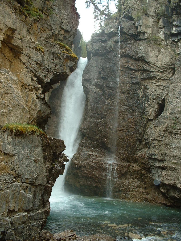
Johnston Canyon and Ink Pots, Banff National Park
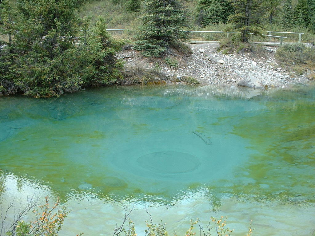
This was our first hike in the Canadian Rockies, chosen because of its relatively short length and limited vertical gain (gotta get acclimated to the altitude!). The trail begins as a paved path through a slot canyon cut through limestone. Apparently there was a large landslide 10,000 years ago or so that diverted the course of a stream which ended up carving out this canyon. Eventually the paved pathway ended and we walked on a wide dirt path (old road?) through a scrubby forest. Finally we started to head downhill and the forest opened up to reveal mountains and the inkpots. The inkpots are a set of springs that reflect different hues of blue and green. I liked the mountains springing up in the background of the springs.
Length:
Vertical Gain:
Weather: Mostly Cloudy, 50s
Dog Rating: I hate you guys (stuck at kennel)
Read more!
Saturday, August 20, 2005
Mason Lake Alpine Lakes Wilderness Area
In preparation for our upcoming trip to the Canadian Rockies, Sara and I wanted to get in a conditioning hike without spending an entire day. We chose to hike up to Mason Lake and were pleasantly surprised at how much we enjoyed this hike just off of I-90. The hike up was your basic hike swichbacking nicely up a steep hillside with nice open meadowlands. Apparently the trail has been recently re-routed so the hike is longer but less steep than before (1,700' in one mile before!). When we reached Mason Lake we found an area of boulders to sit and relax among. Because we had gotten to the trailhead relatively early their weren’t many people at the lake yet and we appreciated that the lake is set back from I-90 and protected by a ridge so it was quiet and peaceful. Another advantage to getting to the trailhead early was that we hiked up the exposed hillside in the relative cool morning. We did not envy the hordes of sweaty people hiking up in the mid-day sun!
Distance: 6.3 miles
Vertical Gain: 2200' (2000' to ridge, 200' down to lake)
Weather: Sunny 60s
Dog Rating: Woof Woof! Too many people to go off-leash, but it was nice to rest at the lake and cuddle with Sara and Dave!
Read more!
Saturday, August 13, 2005
Anderson Butte and Watson Lakes, Noisy-Diobsud Wilderness
I've spent hardly any time in the northern Cascades, so Sara and I chose to do a relatively easy hike in this area. The problem with choosing an "easy" hike is that I sometimes feel lazy and I'm unprepared for any wind-sucking uphills, etc. We first went up Anderson Butte, grazing on blueberries and huckleberries. There were some great patches, especially near the junction between the spur up the Butte and the main trail. The blueberry pancakes the next day were delicious! At Anderson Butte we had an awesome view of Mount Baker and the cragged peaks of the North Cascades. Bella had a tough time however finding a shady spot without sharp rocks (poor pooch). The main trail to Watson Lakes and Anderson Lakes traverses through a beautiful meadow with a stunning view back to Mount Baker, followed by a descent through forest. We went to Watson Lakes, which were two relatively large lakes. At the lower of the two lakes we spent some nice time on a little gravel beach (and Bella scared off the puppy dog "threatening" us) where I polluted the lake with my stinky sweaty feet. Upon return to the parking lot we gave a grateful group a jump to their dead battery!
Distance:
Vertical Gain:
Weather: Sunny 70s
Dog Rating: Pointy rocks at Anderson Butte and little shade, too much berry picking by Dave and Sara (let's hike!), and an annoying puppy at Watson Lakes.
Read more!
Sunday, August 07, 2005
El Presidio National Historic Park, San Francisco
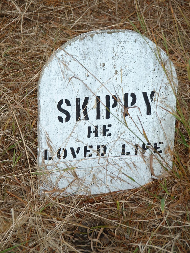
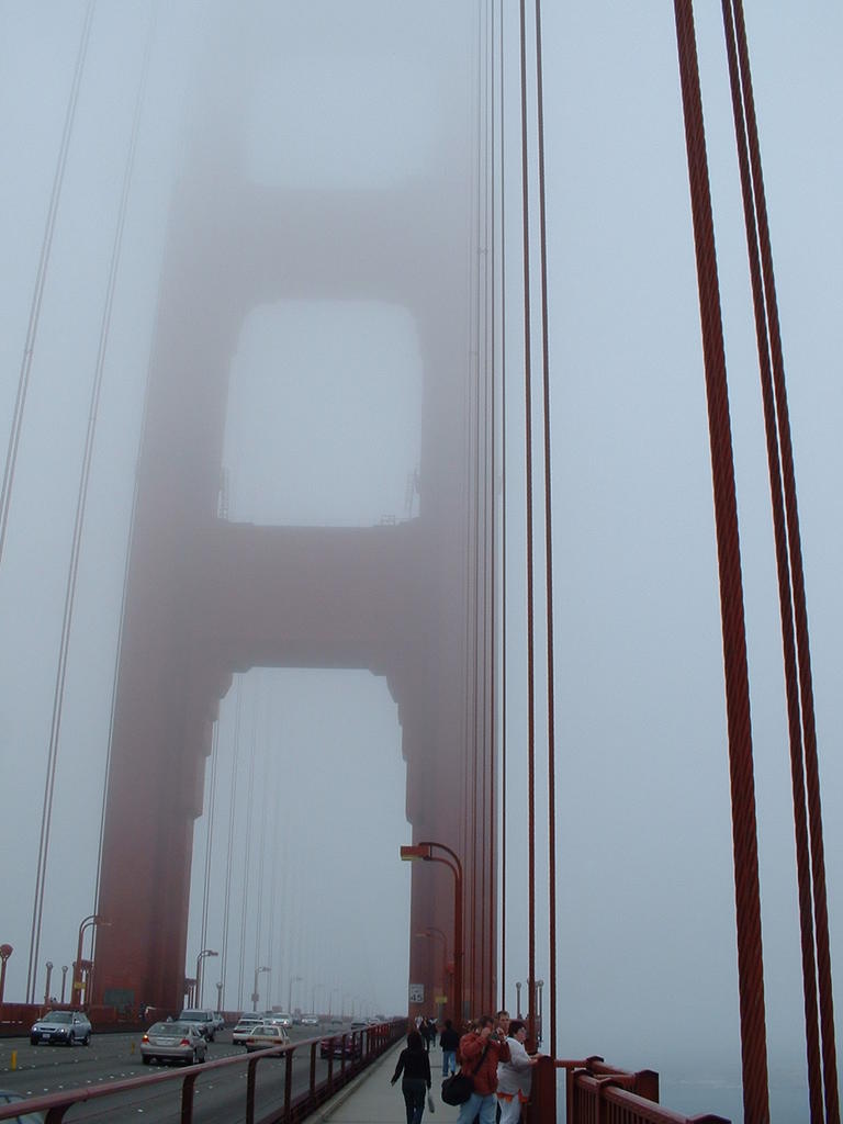
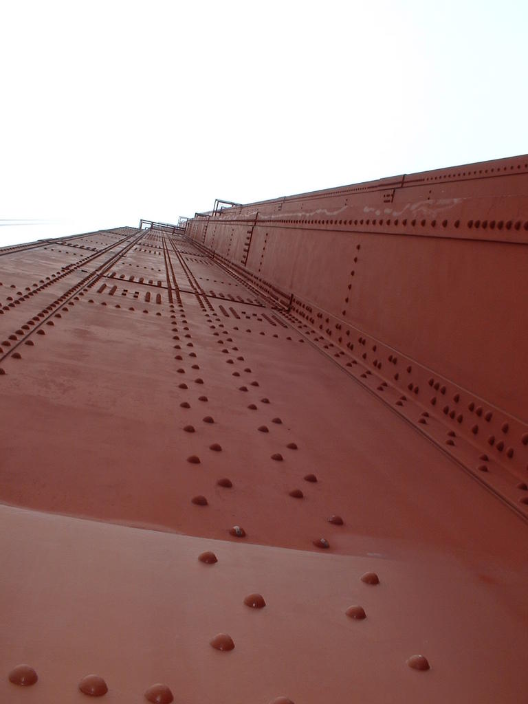
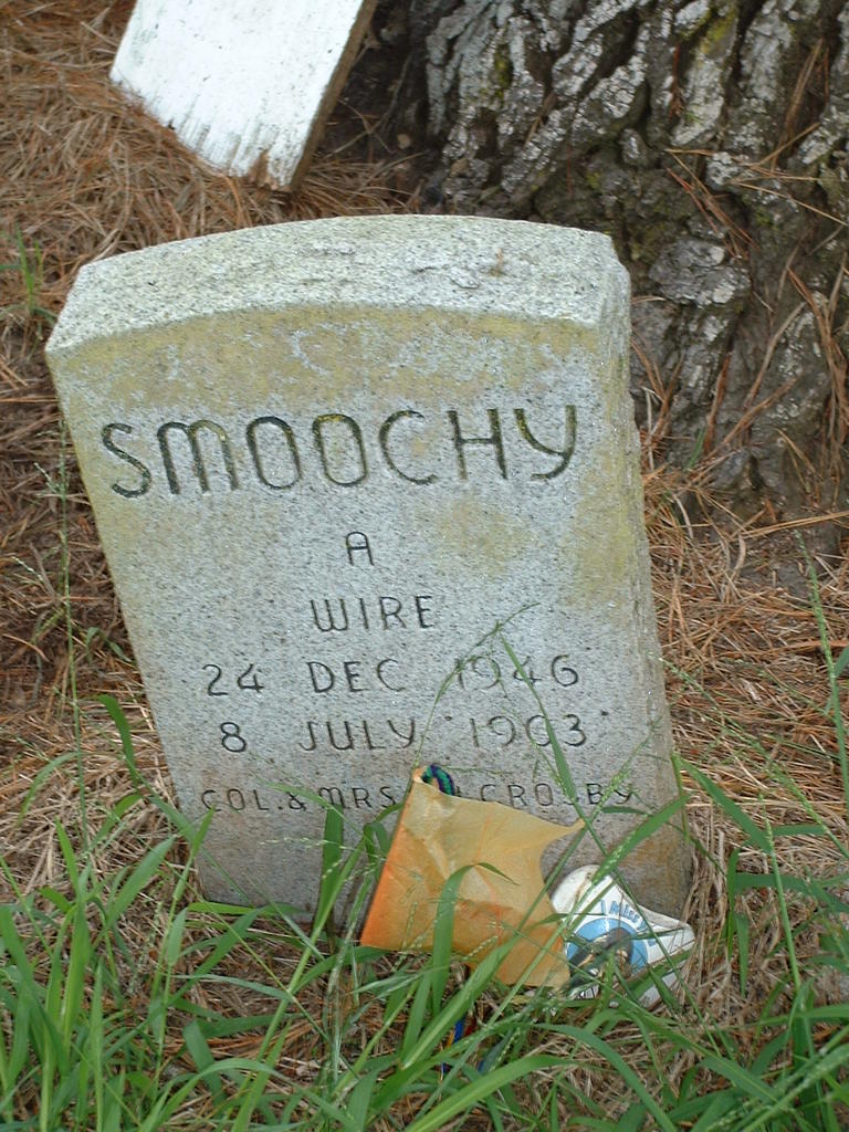
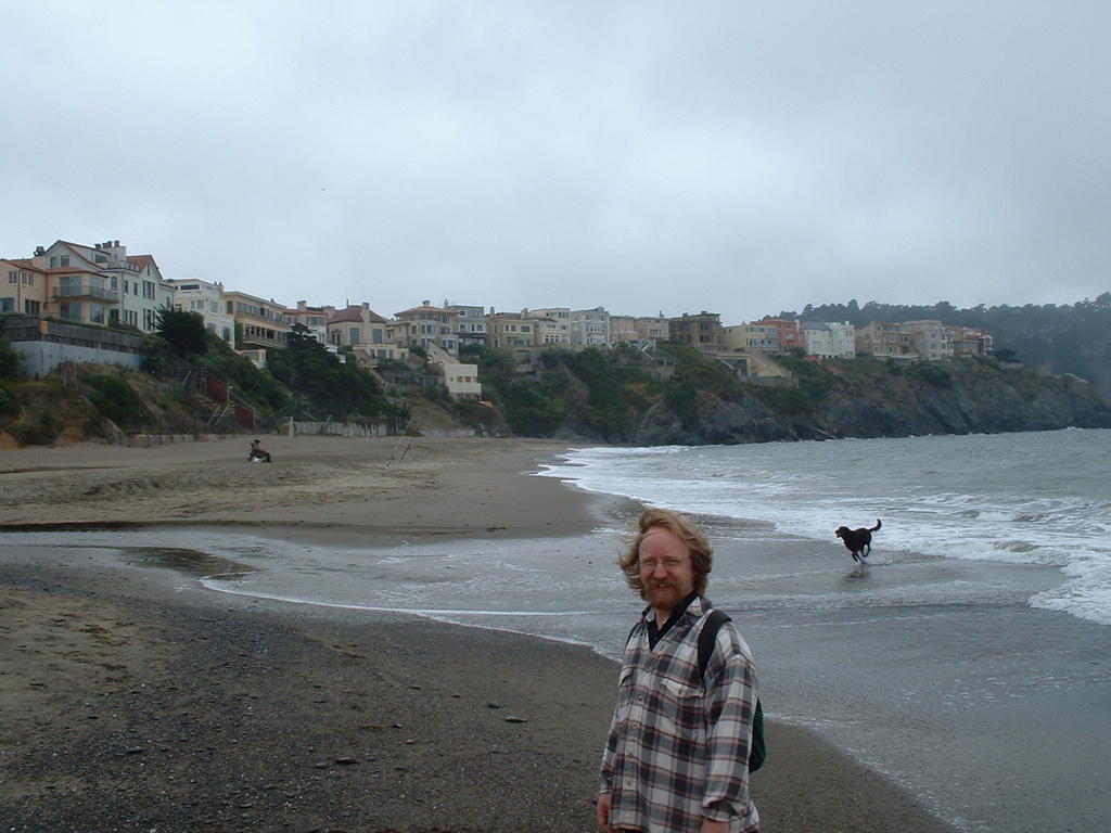
El Presidio is spanish for The Presidio. I was in the Bay Area to go to Eric and Erica's wedding and Gaud and I had most of Sunday to explore San Francisco. We decided to go the Presidio and Golden Gate Bridge. Our first stop was at the Hawaiian Islanders festival where I got some fried zucchini to try to stave off the shakes I had gotten from a large cup of coffee earlier that morning. We then walked towards the bridge, passing by a cool little pet cemetary; I love walking in cities and finding little lagniappes. "Skippy-He Loved Life". We then proceeded to the bridge and crossed it, finding the weather to be remarkably nicer along the Marin County side. We then walked back across the bridge (the fog was dancing across the bridge) and headed along trails on the Pacific Ocean side of the Presidio. Gaud decided to wade in some sewer water, and then we headed back to our car via a maze of trails. Somehow we ended up walking over 11 miles!
Distance: 11.3 miles
Vertical Gain: 200'
Weather: foggy, 50s
Dog Rating: Stuck with Sara in Seattle
Read more!
![]()